The Bureau of Meteorology says heavy rain developing over parts of far western NSW may lead to flash flooding throughout the day.
The system is expected to move over western parts of the Riverina and Central West Slopes and Plains this morning.
A severe weather warning spanning from the Queensland and South Australian borders to the far west of NSW is in place.
Deniliquin, Tibooburra, Cobar, Bourke, Broken Hill and Wentworth are listed as the main areas of concern.
The bureau is predicting six-hourly rainfall totals of 30-40mm with possible localised falls up to 60mm.
Rainfall totals of 50-70mm are likely over a 24 hour period with possible localised falls of up to 100mm in some areas, as thunderstorm clusters embedded in the rain band move over the state.
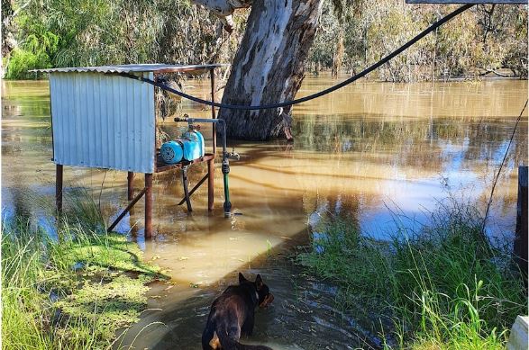
[caption id="attachment_27898" align="alignnone" width="587"]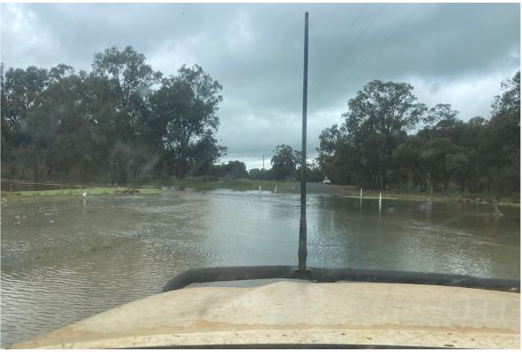 Water laps at Gipps Way outside Condoblin and has cut Lake Cargelligo Road at Banar Swamp.(Supplied: Bec Dance)[/caption]
Burndoo, south east of Wilcannia, recorded 44mm between 1am and 4am.
BOM senior meteorologist Dean Narramore said major flooding was possible later this week and into the weekend, with the potential of three rounds of rain set to hit the east of the country.
"Pretty much all river catchments across northern Victoria are under a flood watch, and almost every river on and west of the ranges in NSW is also on a flood watch," Mr Narramore said.
"Rivers and areas of most particular concern are the southern parts of the North West Slopes and Plains down to the Central West Slopes and Plains of NSW.
"Rivers like the Macquarie, Namoi, Lachlan, Bogan we're already seeing moderate to major flooding … and additional rainfall is likely to lead to renewed river rises," he said.
The State Emergency Service (SES) said they performed a flood rescue in Gunnedah overnight with assistance from Ambulance NSW, and so far have seen rain impacting mostly rural areas and not more populous town centres.
 Farmers along the Lachlan River have to use boats to get around their properties. (Supplied: Kerry Davis)[/caption]
Slight reprieve
SES western zone's David Rankine said the Central West and Orana region did not receive the volume of rain expected overnight, with the brunt of the rain falling in the Riverina.
"We're pretty confident by the look of this that western NSW has kind of skipped the worst of the rainfall overnight which gives us a bit of a reprieve ahead of what we're expecting to be quite intense rainfall in the next 48 hours," Mr Rankine said.
"We're certainly not resting on our laurels because there's a second front coming through … dropping what is predicted to be a significant amount of rain."
The SES is urging residents and holiday-makers in affected regions to check its new warning system HazardWatch on its website, with more rain forecast for the remainder of the week as a second wet weather system moves through from Friday.
Source: ABC News