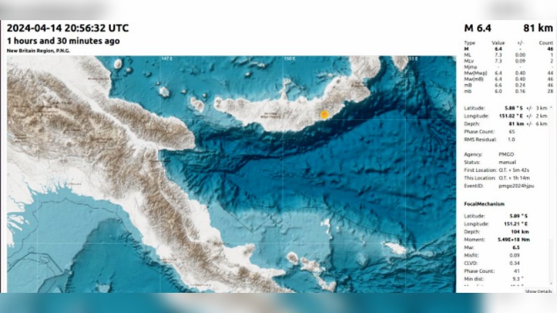
A 6.4 magnitude earthquake struck the southern coast of East New Britain (ENB) province this morning at around 6:57am.
As per report from the Port Moresby Geophysical Observatory (PMGO) of the Department of Mineral Policy and Geohazards Management, the earthquake occurred as a result of interaction between the Solomon Sea and South Bismarck micro plates, in the vicinity of Pomio District, approximately 200 km southwest of Kokopo, East New Britain Province and about 588 kilometres northeast of Port Moresby city.
Acting Assistant Director for PMGO, Mr Matthew Moihoi told PNG HAUSBUNG that the depth of the earth quake is 81 kilometre and its location on the scale is 5.88 degrees S, 151.02 degrees, at the deeper part of the subducting Solomon Sea Plate at an area of known seismic zone.
“The people of Pomio felt the most effect and at the same time the earthquake may have been felt in Kimbe and other parts on New Britain Island,” he said.
“At the meantime, there has not been any report of any damages from this earthquake received by PMGO in the affected areas.”
Mr. Moihoi further clarified that the earthquake occurred in land and therefore, no tsunami warning has been issued.

